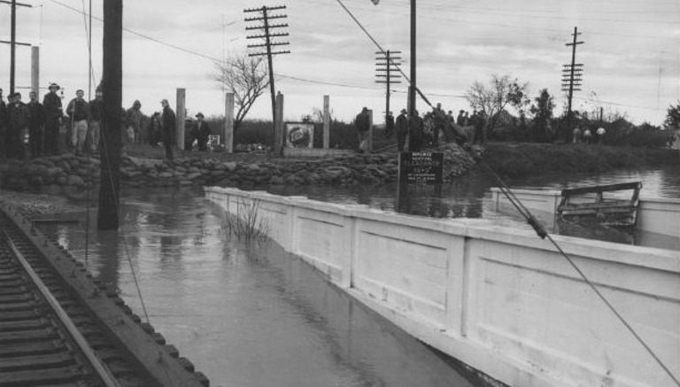
At the time of the Yuba City flood in December 1955, it was considered the most severe natural disaster in California since the 1906 San Francisco earthquake. Starting December 18 and lasting for nine unrelenting days, torrential rain accompanied by high-speed wind drenched nearly 100,000 square miles. There were areas that were covered in 50 feet of water at times. The water runoff resulted in floods that washed away railroads and highways, destroyed farmlands, submerged towns, drowned animals and overwhelmed thousands of homes.
The result of the intense flood left 38 dead, more than 4,000 injured and forced the evacuation of 40,000 residents from their homes. The cost of the damage was reported to amount to $100 million, equivalent to $3.4 billion in 2024.
Causes of the flood—and the response
A combination of factors led to the massive Yuba City flood of 1955. Hydraulic mining at the turn of the twentieth century eroded hillsides and altered waterways, which were less able to accommodate normal water flow and excessive sedimentation. Inadequate levee systems also contributed to the devastation.
In 1959, the Yuba Water Agency was created to reduce the risk of future floods and maintain a reliable water supply for residents of Yuba County, which sits right on the other side of the Feather River from Yuba City.
Two years later, in 1961, Yuba County voters approved $185 million in revenue bonds (three times the total county assessment at the time). The money was used to fund the Yuba River Development Project, which included three dams: New Bullards Bar, Our House and Log Cabin, completed in 1970.
Another planned infrastructure project for the Yuba River, which would have reduced flood risk even more, was never built. The federal government’s planned Marysville Dam would have had the capacity to hold 260,000 acre feet—even more flood storage than Bullards Bar.
More flooding
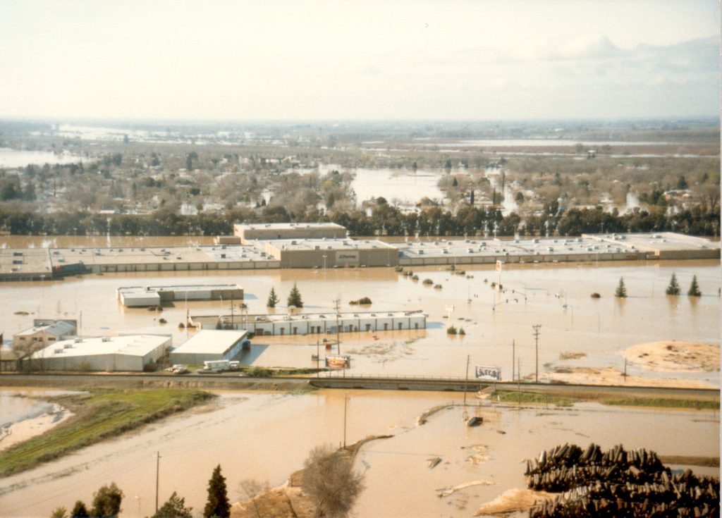
The next major flood that hit the region occurred in 1986, when levee failures destroyed thousands of homes, a major mall, killed two people and forced 26,000 residents to evacuate Linda, Olivehurst and Arboga (now known as Plumas Lake). Damage was estimated at $464 million. After the flood, government officials determined that the levee system was in dire need of repair and improvement.

Before that work could be completed, however, a levee failure in Arboga caused another devastating flood in 1997, which claimed three lives and caused more than $300 million in damage.
“Over the past 40 years, I’ve evacuated from my Yuba County home three times from the threat of floodwaters: in 1986, 1997 and again in 2017,” says Ryan McNally, Director of Water Resources and Flood Risk Reduction for Yuba Water. “It’s hard to find the words to describe the emotions surrounding your community being threatened by water and knowing that at any moment everyone’s livelihood might be lost.”
Economic Impact
In fact, McNally says flooding has adversely affected the local economy more than anything else, beginning with the 1986 flood that devastated the community of Linda and effectively shuttered the then-thriving Peach Tree Mall. Those impacts were exacerbated by the 1997 event, which inundated the area now occupied by homes in Plumas Lake.
After the floods, many people left Yuba County never to return, McNally says, a further drag on the economy. This confirmed the need to implement major upgrades to the region’s levee system, so in 1998, 1999 and 2000, significant projects were approved at both the state and federal levels.
These included $28 million from the Army Corps of Engineers for flood protection; the authorization by Congress of the Yuba River Basin Project to strengthen area levees; and the creation of the Yuba Feather Flood Protection Program, which provided nearly $90 million in state funds for levee improvements in the area managed by the Reclamation District 784 in south Yuba County.
“We are definitely considering storms coming more frequently and potentially the magnitude being greater—and are constantly working on ways to reduce flood risk with those factors in mind.”
John James, Director of Resource Planning
Yuba Water Agency
“The levees around the flood prone areas in ’86 and ’97 have undergone significant improvements since those two floods,” says Willie Whittlesey, General Manager of Yuba Water Agency. “We are now at a level that is commonly called ‘200-year protection.’ But that name is misleading. It means there is a 1-in-200 chance in any given year that our urban areas will experience a storm that will overwhelm our levee system. The levees have a great maintenance program that Reclamation District 784 maintains and these levees are some of the best in California. So people should be confident that their risk is significantly reduced with all the work that’s gone into this.”
Whittlesey says the region can look to an optimistic future. He adds another sign of progress was the opening of a Costco Wholesale this year on the site where the heavily damaged mall once stood. The empty mall was demolished in the summer of 2022.
Work—and Concerns—Remain
Despite infrastructure improvements, other factors like climate change could cause more extreme weather events that can potentially produce major floods in the future.
“We are definitely considering storms coming more frequently and potentially the magnitude being greater—and are constantly working on ways to reduce flood risk with those factors in mind,” says John James, Director of Resource Planning at Yuba Water Agency. “We are always working on enhancing our operation’s decision-making tools and collaborating with academia and our partner agencies to improve atmospheric river forecasts to better predict when they will occur and how they impact our watershed. A project we are currently working on that is in the planning phase is building another spillway at our dam, with gates much lower in the dam, which would allow the release of more water ahead of a major storm. There are a lot of projects we are always working on to reduce flood risk.”
For more information on Yuba Water Agency’s flood and disaster preparedness programs and projects, visit https://www.yubawater.org/. Also learn more by watching Yuba Water’s documentary, “The Tricky Yuba,” on YouTube. Are you interested in hosting a screening of “The Tricky Yuba?” Contact DeDe Cordell at dcordell@yubawater.org.


