Created in 1959, Yuba Water Agency was formed in response to a catastrophic flood in 1955 that displaced 40,000 residents of Yuba City and killed 38. This disaster, caused by a levee collapse on the Feather River, convinced local authorities of the need for an agency to improve flood control systems in Yuba County.
Since then, Yuba Water has worked with other local agencies as well as the state and federal government to continuously reduce flood risk for the region through both operational and infrastructure improvements.
“It’s a continual effort that will last forever,” says Willie Whittlesey, General Manager of Yuba Water, “but we’re making great strides.”
These great strides have included the construction of New Bullards Bar Dam and Reservoir back in 1970 and helping to fund major levee improvements throughout the county.
“The New Bullards Bar Reservoir helped significantly,” Whittlesey says. “It provided 170,000 acre-feet of dedicated flood storage for the Yuba River system.”

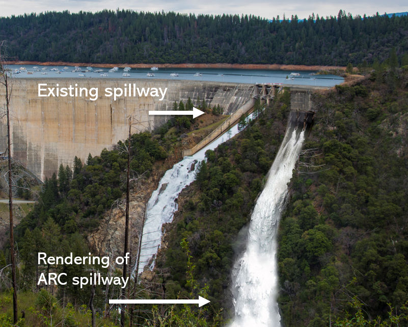
But this reservoir can be made even more effective. The dam’s current spillway sits very high in the dam, requiring the reservoir to be nearly full before water can be released to make room for incoming storm flows. To improve the reservoir’s storage capacity, Yuba Water is finalizing plans for the Atmospheric River Control Spillway, which will be 31 feet lower than the existing spillway. This new spillway will allow for much earlier releases before a storm arrives, which will help to relieve pressure on downstream flood risk reduction infrastructure.
The more water stored In the reservoir during high flows, the less pressure on the river’s levees, and the less risk of catastrophic levee collapse.
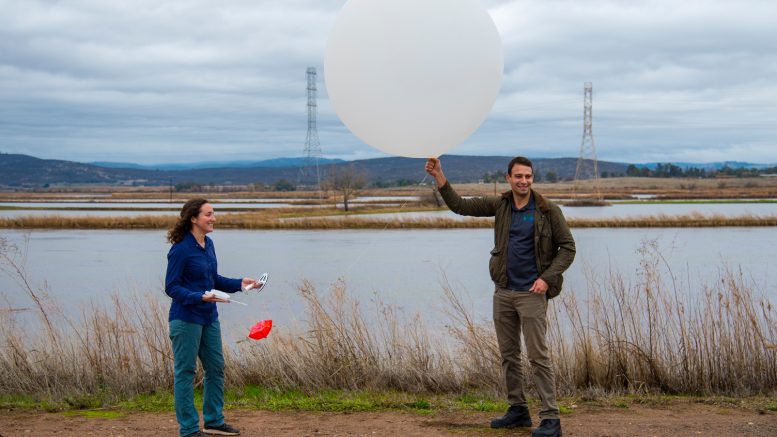
This project will be supplemented by the latest science and technology. Yuba Water is working with the Scripps Institution of Oceanography at UC San Diego to implement Forecast-Informed Reservoir Operations, or FIRO. Scripps uses weather devices called dropsondes to study atmospheric rivers over the Pacific, collecting data in order to predict where and when these atmospheric rivers will make landfall and how much precipitation they will release.
“We’re getting more detailed information on these atmospheric rivers,” Whittlesey says. “That way, when we operate the new ARC Spillway under a FIRO regime, we can be confident that the timing of our operation maximizes the benefit of the flood space we create.”
The planned ARC Spillway is just one of many of ongoing projects for Yuba Water. The Marysville Ring Levee, a levee system surrounding the city of Marysville and reducing risk for more than 12,000 people, is nearly complete after 15 years of development by the Marysville Levee Commission, the California Department of Water Resources and the U.S. Army Corps of Engineers, with support from Yuba Water.
“It’s a very complicated system due to all the infrastructure in and around Marysville,” says Whittlesey. “But in the next few years it will be complete and the city will have modern levees that meet or exceed the state’s requirements for urban areas.”
Next, Yuba Water wants to help improve rural levees.
“Originally we focused on the urban areas,” says Whittlesey. “We were thinking, ‘Let’s improve the levees that reduce risk to the most residents.’ But the outlying areas of Yuba County have the same or worse flood risk. We’re helping Reclamation District 10 on the north side of the county with a new inspection road all the way around their levee. We’re always investigating the next best investment.”
While the work of Yuba Water may be a “continual effort that will last forever,” each step they take should make the residents of Yuba County feel a little bit safer when storms roll in.
For more information on Yuba Water Agency’s flood and disaster preparedness programs and projects, visit https://www.yubawater.org/.


